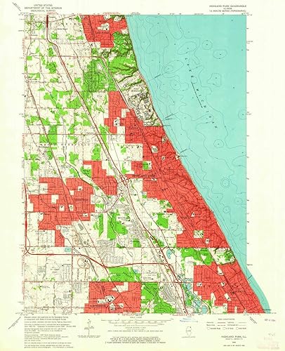
Printed on Polypropylene (plastic) USGS topographic map of Highland Park, IL, at 1:24000 scale. Heavier material. Waterproof. Tear-resistant. Foldable. Perfect for the outdoors. Cities, towns, villages: Deerfield,The Colonnades,Marlen Subdivision,Bradless Subdivision,Timber Lane,Maple Ridge,Sycamore Lane,Bachs Addition,Lane Park,Northbrook Heights,Bannockburn,Charring Cross,Heart O' Northbrook,Northbrook Colonial Estates,Buttonwood,Sunridge,Red Haw Ridge,Saint Stephens Green,Star Subdivision,Wildebrook On The Green,Charlemagne East,Pheasant Creek,Northbrook Oaks,Meyer's Subdivision,Tiber Hill Estates,Old Colony Court,Northbrook Highlands,Fair Acres Islands: Consult topo map preview for visible islands. Parks and forests: John Blumberg Park,Manot Park,Briarwood Park,Coast Guard Park,Sherwood Park,Mooney Park,Old Elm Park,Memorial Park,Hillside Park,Centennial Park,Indian Ridge Park,Woodridge Park,South Park,Crestwood Park,Wilmot Park,Maplewood Park,Snyder Park,Buckthorn Park,Shelton Park,Kipling Park,Trail Tree Park,Northcroft Park,Leonardi Park,Prairie Wolf Slough County Forest Preserve,Lincoln Place Park,Idlewild Park,Sherwood Park,Olson Park,John F Kennedy Park,Greenfield Park
ASIN B07L32K7MD Producto en Tienda desde diciembre 3, 2018