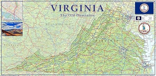
Physical Map of Virginia State - 11.3 x 23.3 Inches - Paper Laminated
Categoría: Maps
Envío gratis
Precio y disponibilidad de Physical Map of Virginia State - 11.3 x 23.3 Inches - Paper Laminated
$ 206.777
Stock disponible
Tiempo de entrega estimada Domingo 8 de marzo al Sábado 14 de marzo.